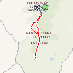
![](/images/other/stat-length.png)
![Trail Walking Les Contamines-Montjoie - CONTAMINES-MONTJOIE (Chalet/Refuge de la Balme). - Photo](https://media.geolcdn.com/t/1900/400/ext.pjpeg?maxdim=2&url=https%3A%2F%2Fservices.sitytrail.com%2FGeolivesWS%2FDownloadMedia.ashx%3FTrailID%3D997092%26Media%3Dfix__20180701161208.jpg)
CONTAMINES-MONTJOIE (Chalet/Refuge de la Balme).
GerardBouche
User
![Length](/images/other/stat-length.png)
![Max alt](https://static1.geolcdn.com/siteimages/upload/files/1508320355ic_sort_altitude_max_24dp.png)
![Uphill gradient](https://static1.geolcdn.com/siteimages/upload/files/1508320355ic_sort_den_pos_24dp.png)
![Km-Effort](/images/other/stat-length.png)
![Min alt](https://static1.geolcdn.com/siteimages/upload/files/1508320355ic_sort_altitude_min_24dp.png)
![Downhill gradient](https://static1.geolcdn.com/siteimages/upload/files/1508320355ic_sort_den_neg_24dp.png)
![Boucle](https://static1.geolcdn.com/siteimages/upload/files/16400158638029165_repeat_loop_refresh_sync_direction_icon.png)
![Walking](https://static1.geolcdn.com/sitytour/trail-icons/101.png)
4h02
Difficulty : Medium
![Scan this QR Code to open this trail in the SityTrail application](https://capi.geolives.com/qq0zvz2zws4bq2lad0pu/sitytour/trails/997092/qr.png?size=200)
FREE GPS app for hiking
About
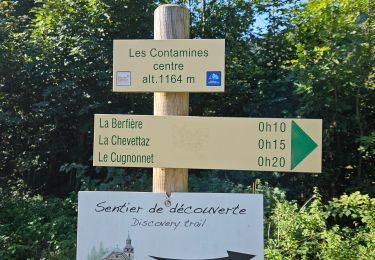
Trail Walking of 11.1 km to be discovered at Auvergne-Rhône-Alpes, Upper Savoy, Les Contamines-Montjoie. This trail is proposed by GerardBouche.
Description
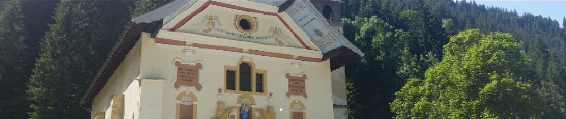
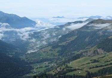
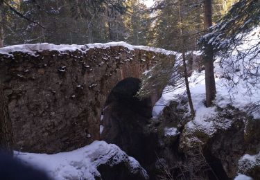
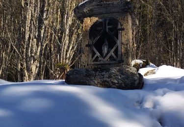
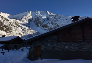
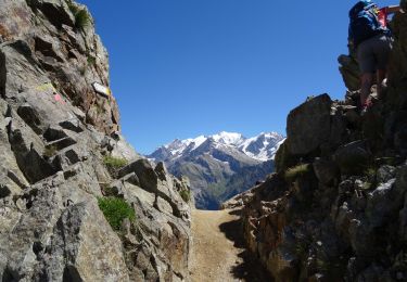
Très belle rando au départ de N-D de la Gorge jusqu'au chalet de la Balme. Redescendre jusqu'au Refuge de Nant Borrant et bifurquer à gauche pour y trouver un petit sentier forestier bien ombragé dans l'Anery avant de terminer ce très beau parcours.
Positioning
Comments
Trails nearby
![Trail Walking Les Contamines-Montjoie - suuntoapp-Hiking-2024-09-11T06-11-40Z - Photo](https://media.geolcdn.com/t/375/260/3bd03f88-8d5f-4a59-aa8b-ba38887cd8e5.jpg&format=jpg&maxdim=2)
![Walking Walking](https://static1.geolcdn.com/sitytour/trail-icons/101.png)
Walking
![](/images/other/stat-length.png)
![](https://static1.geolcdn.com/siteimages/upload/files/16400158638029165_repeat_loop_refresh_sync_direction_icon.png)
![Trail Touring skiing Les Contamines-Montjoie - tricotage vers la pointe de Chaborgne - Photo](https://media.geolcdn.com/t/375/260/dc2f0b79-ec9b-4a8c-8239-b2a04beff144.jpg&format=jpg&maxdim=2)
![Touring skiing Touring skiing](https://static1.geolcdn.com/sitytour/trail-icons/503.png)
Touring skiing
![](/images/other/stat-length.png)
![](https://static1.geolcdn.com/siteimages/upload/files/16400158638029165_repeat_loop_refresh_sync_direction_icon.png)
![Trail Touring skiing Les Contamines-Montjoie - Pointe Nord du Mont Jovet - Photo](https://media.geolcdn.com/t/375/260/9d6d2299-8e56-40c0-8b26-0c7c6be83540.jpg&format=jpg&maxdim=2)
![Touring skiing Touring skiing](https://static1.geolcdn.com/sitytour/trail-icons/503.png)
Touring skiing
![](/images/other/stat-length.png)
![](https://static1.geolcdn.com/siteimages/upload/files/16400158638029165_repeat_loop_refresh_sync_direction_icon.png)
![Trail Touring skiing Les Contamines-Montjoie - Le Monthieu - Photo](https://media.geolcdn.com/t/375/260/2801a48f-dd22-4fd5-9977-e949a424db1c.jpg&format=jpg&maxdim=2)
![Touring skiing Touring skiing](https://static1.geolcdn.com/sitytour/trail-icons/503.png)
Touring skiing
![](/images/other/stat-length.png)
![](https://static1.geolcdn.com/siteimages/upload/files/16400158638029165_repeat_loop_refresh_sync_direction_icon.png)
![Trail Touring skiing Les Contamines-Montjoie - Couloir de la chèvre - Photo](https://media.geolcdn.com/t/375/260/7b0e2a8c-f557-4c8d-9a94-00ce575299e1.jpg&format=jpg&maxdim=2)
![Touring skiing Touring skiing](https://static1.geolcdn.com/sitytour/trail-icons/503.png)
Touring skiing
![](/images/other/stat-length.png)
![](https://static1.geolcdn.com/siteimages/upload/files/16400158638029165_repeat_loop_refresh_sync_direction_icon.png)
![Trail Touring skiing Les Contamines-Montjoie - col de la Cigle - Photo](https://media.geolcdn.com/t/375/260/b5d2bc8c-14f8-4ce4-89cd-ce0c81c6c5a2.jpg&format=jpg&maxdim=2)
![Touring skiing Touring skiing](https://static1.geolcdn.com/sitytour/trail-icons/503.png)
Touring skiing
![](/images/other/stat-length.png)
![](https://static1.geolcdn.com/siteimages/upload/files/16400158638029165_repeat_loop_refresh_sync_direction_icon.png)
![Trail Walking Hauteluce - SityTrail - col de la fenêtre - Photo](https://media.geolcdn.com/t/375/260/dd46ff30-f5d6-4a8c-bd42-b5e111a120d9.jpg&format=jpg&maxdim=2)
![Walking Walking](https://static1.geolcdn.com/sitytour/trail-icons/101.png)
Walking
![](/images/other/stat-length.png)
![](https://static1.geolcdn.com/siteimages/upload/files/16400158638029165_repeat_loop_refresh_sync_direction_icon.png)
![Trail Walking Les Contamines-Montjoie - J20 - R19 - Les Contamines-Montjoie et la base de loisirs du Pontet - Photo](https://media.geolcdn.com/t/375/260/58aa3dc7-c4b8-4549-ad89-882741e5204d.jpg&format=jpg&maxdim=2)
![Walking Walking](https://static1.geolcdn.com/sitytour/trail-icons/101.png)
Walking
![](/images/other/stat-length.png)
![](https://static1.geolcdn.com/siteimages/upload/files/16400158638029165_repeat_loop_refresh_sync_direction_icon.png)
![Trail Walking Hauteluce - lacs jovet col de joly 1015m 20kms - Photo](https://media.geolcdn.com/t/375/260/40e6ff73-9c33-483f-b0ca-4ba9aa46521a.jpg&format=jpg&maxdim=2)
![Walking Walking](https://static1.geolcdn.com/sitytour/trail-icons/101.png)
Walking
![](/images/other/stat-length.png)
![](https://static1.geolcdn.com/siteimages/upload/files/16400158638029165_repeat_loop_refresh_sync_direction_icon.png)